Using grid references to identify land use
I can use four figure grid references to identify different examples of land use in my local area on a 1:25000 map.
Using grid references to identify land use
I can use four figure grid references to identify different examples of land use in my local area on a 1:25000 map.
These resources will be removed by end of Summer Term 2025.
Switch to our new teaching resources now - designed by teachers and leading subject experts, and tested in classrooms.
These resources were created for remote use during the pandemic and are not designed for classroom teaching.
Lesson details
Key learning points
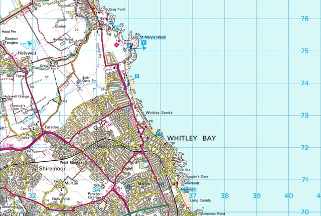
- The map of Great Britain is covered by grid squares measuring 100 kilometres across
- OS maps have a series of grid lines that help you to pinpoint an exact location anywhere on the map
- Vertical lines are called 'eastings' as they increase in value as you travel east on the map
- The horizontal lines are called 'northings' as they increase in value as you travel north on the map
Keywords
Vertical - Something vertical stands upright or points upwards from the ground.
Horizontal - Something horizontal is parallel to the ground.
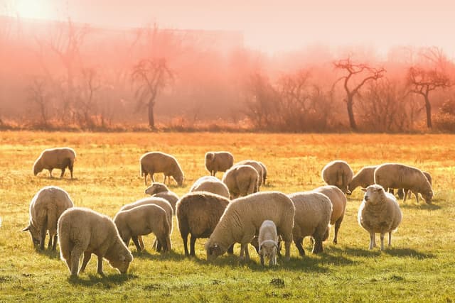
Pasture - Pasture is land, with grass and other low plants, suitable for livestock to graze on.
Agriculture - Agriculture is the science and practice of cultivating soil and farming.
Common misconception
Pupils may be aware of the National Grid as the network which is used to supply electricity.
Explain that the National Grid for OS maps is not (quite) the same thing.
To help you plan your year 3 geography lesson on: Using grid references to identify land use, download all teaching resources for free and adapt to suit your pupils' needs...
To help you plan your year 3 geography lesson on: Using grid references to identify land use, download all teaching resources for free and adapt to suit your pupils' needs.
The starter quiz will activate and check your pupils' prior knowledge, with versions available both with and without answers in PDF format.
We use learning cycles to break down learning into key concepts or ideas linked to the learning outcome. Each learning cycle features explanations with checks for understanding and practice tasks with feedback. All of this is found in our slide decks, ready for you to download and edit. The practice tasks are also available as printable worksheets and some lessons have additional materials with extra material you might need for teaching the lesson.
The assessment exit quiz will test your pupils' understanding of the key learning points.
Our video is a tool for planning, showing how other teachers might teach the lesson, offering helpful tips, modelled explanations and inspiration for your own delivery in the classroom. Plus, you can set it as homework or revision for pupils and keep their learning on track by sharing an online pupil version of this lesson.
Explore more key stage 2 geography lessons from the Land use: how diverse are local and UK landscapes? unit, dive into the full secondary geography curriculum, or learn more about lesson planning.

Licence
Lesson video
Loading...
Starter quiz
6 Questions

form in upland areas with wet and waterlogged conditions
purple heather and low-growing shrubs found in higher areas
can be coniferous or deciduous
Exit quiz
6 Questions